Property media guide · 6 minute guide
When drone photography and film help a property—and when they do not
A practical guide to using aerial photography for acreage, views, access, hospitality destinations, and property films.
01
Use aerial media to answer a question
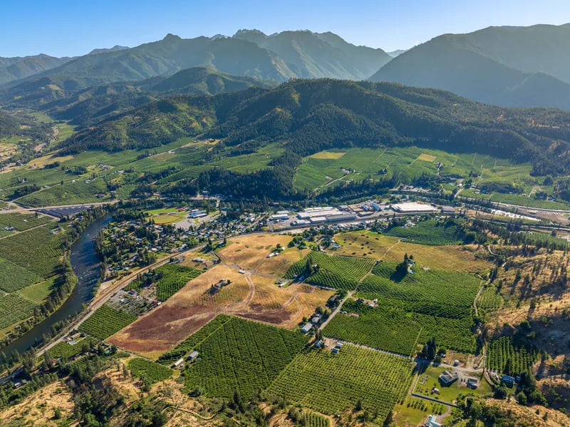
The strongest drone image usually answers something ground photography cannot: Where is the home in relation to the view? How does the road reach the property? What is the scale of the land? How private is the setting? How close are multiple structures or amenities?
If altitude does not reveal useful information or add genuine emotional context, ground-based coverage may be stronger.
02
Properties that often benefit
Aerial coverage is especially useful when the land, surrounding landscape, approach, or relationship between structures is central to the property's value or experience.
- Acreage, orchards, and land listings
- Mountain, river, lake, or valley-view properties
- Cabins and destination rentals defined by privacy or setting
- Properties with multiple buildings or outdoor amenities
- Hotels, resorts, commercial sites, and location-driven brands
03
Still photographs and film solve different problems
Aerial stills are efficient for orientation and comparison. Film can reveal a sequence: approach, rise, reveal, movement across the property, and transition into the wider landscape. A useful project may need one, both, or neither.
04
Conditions are part of the plan
Visibility, wind, weather, airspace, site access, and the direction of light all affect aerial work. Share the exact location and deadline early. Aerial coverage should be planned as part of the visual story, not treated as an automatic add-on after every other decision is made.
05
Plan the edit before takeoff
For a combined property film, decide what each aerial shot needs to connect. A wide reveal can establish place, a lower move can show the approach, and a transition can connect exterior scale to the ground-level experience. Purposeful movement makes the final film feel intentional and keeps the property—not the aircraft—as the subject.
Quick answers
Common questions about this part of the process.
Does every aerial shoot need very high altitude?
No. Lower aerial perspectives often preserve more property detail and human scale. The useful height depends on what the image needs to explain.
Can drone footage be delivered for vertical social video?
Yes, when vertical use is planned before capture. Composition and flight paths should account for the final frame rather than relying only on a later crop.
Can aerial work be guaranteed for a specific date?
Conditions and location constraints can affect flight plans. Share any fixed deadline early so the project can be planned realistically.