Orientation
Aerial views can show boundaries in context, approach roads, neighboring terrain, and how the property sits within a valley, forest, or mountain setting.
Land · views · access · context
High-resolution aerial photography and cinematic drone footage for property, hospitality, commercial, and destination storytelling.
Request availability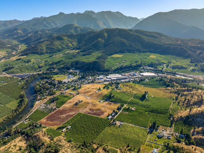
A good fit for
What the coverage prioritizes
Aerial views can show boundaries in context, approach roads, neighboring terrain, and how the property sits within a valley, forest, or mountain setting.
Altitude gives viewers a clearer understanding of acreage, spacing, structures, and the relationship between built and natural features.
Drone film works best when each move reveals useful information—not simply because the camera can fly.
Coverage can include
High-resolution aerial still photography
Cinematic aerial footage for property films and brand edits
Vertical-friendly aerial compositions when social delivery is planned
Ground-and-air coverage planned as one visual sequence
Location evaluation based on conditions, airspace, and the needs of the project
Questions about drone photography + film
Not automatically. Weather, visibility, the site, airspace, safety, and the story the property needs to tell all affect whether aerial coverage makes sense.
Yes. Aerial-only projects can be discussed, and drone coverage can also be integrated with ground photography or a larger film.
Send the exact location, the features or views that matter, the intended use, your deadline, and any property access information that could affect planning.
Have a property in mind?
Tell Nate what you are marketing, where it is, and when you need the media.
Start your inquiry nate@leavenworthphotoandfilm.com